The environment plays a key role in the design process, in which Stretto di Messina has invested heavily in organisational, human and financial terms. The aim is to create a body of scientific knowledge that will be made available to local communities and lead to ongoing studies of the local area.
To do this, we have adopted a new approach based on transparent processes and outcomes. It takes into account local relations and heritage and has been shared with public bodies and institutions, creating an asset that will benefit the local area.
In line with Italian and European legislation, the Company has devised an Environmental, Territorial and Social Monitoring Plan, designed not only to ensure the environmental compliance of construction sites and but also to study the project’s impact on the wider area.
THE MONITORING PLAN STRATEGY
Voluntary extension of the areas to be monitored in accordance with the law to create a Broad Area Monitoring system that aims to assess the environmental, territorial and social effects within a wider context, going beyond the areas directly affected by the works.
The integration of environmental aspects into the design process (in both the final and detailed designs), involving all the various players (the General Contractor, Eurolink, the Environmental Monitor, Edison Next Environment and the Project Management Consultant, Parsons Transportation Group) in the environmental monitoring process from before the start-up of work.
MAIN AIMS OF THE MONITORING PLAN
To control and measure the real effects of the project compared with those foreseen in the Environmental Impact Study;
To verify the effectiveness of mitigation measures and report any shortcomings;
To identify unexpected impacts and propose corrective measures;
To support decision-making by technicians and public bodies during construction;
To provide transparency and public disclosure, including in relations with scientific bodies and institutions.
THE MAIN AREAS COVERED BY THE MONITORING PLAN
This is a “unified” monitoring plan based an integrated, multidisciplinary approach, able to bring together all the aspects assessed within a single, coherent system.
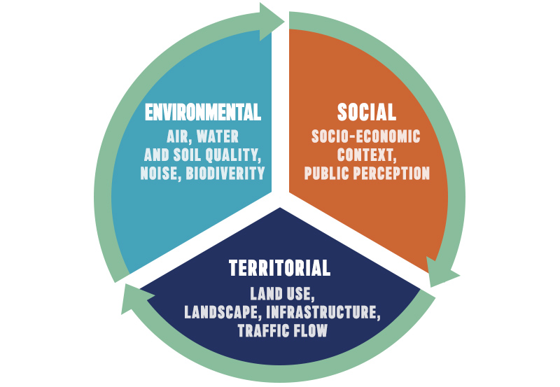
THE ENVIRONMENTAL COMPONENTS MONITORED
The Plan includes 7 environmental macro-components, each subdivided into sub-components:
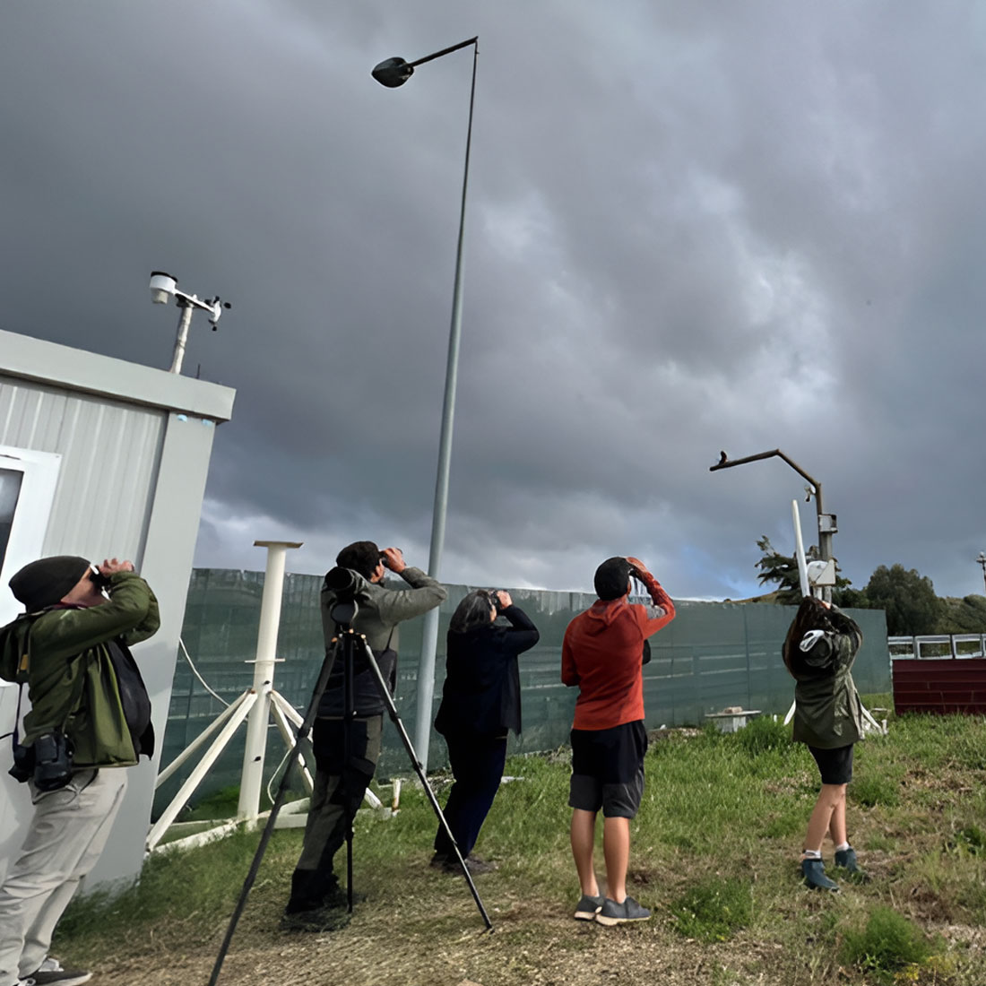
Atmosphere – air quality, dust, asbestos, traffic, meteorology
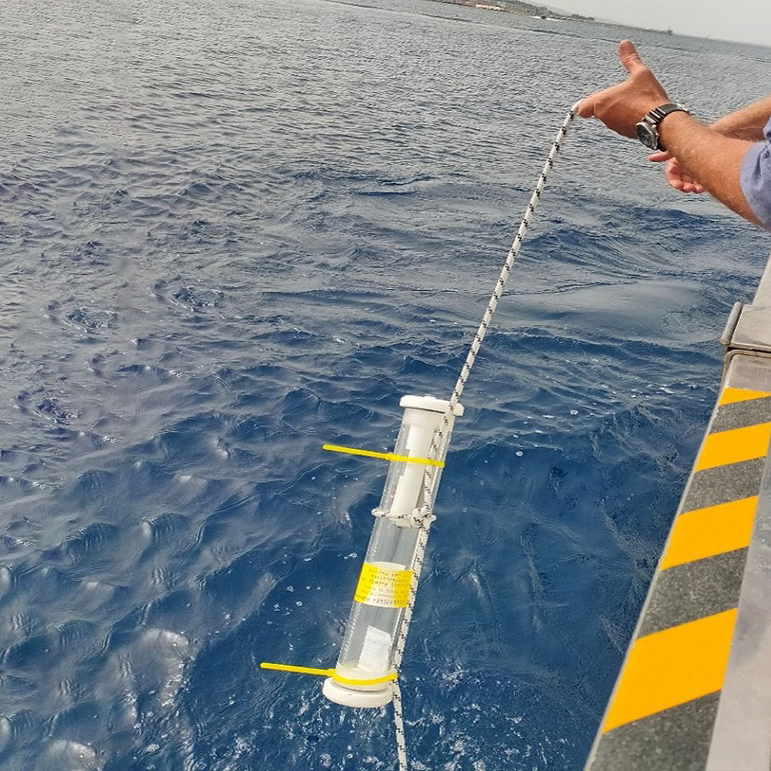
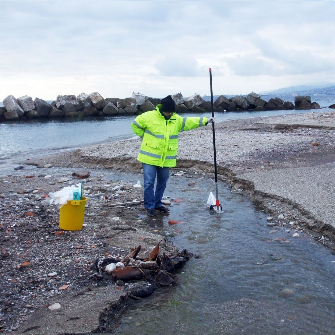
Water – marine environment, surface water and groundwater
Soil and subsoil – geotechnical stability, pedology
Biodiversity – fauna, flora, land and marine habitats
Landscape and cultural heritage – visual and cultural impacts
Social environment – socio-economic assessment and public perception
THE PLAN CONSISTS OF THREE OPERATIONAL PHASES
PRIOR TO CONSTRUCTION
when the initial state of the environment prior to the start-up of work is documented, providing a complete and detailed baseline.
DURING CONSTRUCTION
when the temporary effects linked to site activity are monitored with the aim of managing any impacts in real time.
AFTER CONSTRUCTION
when the effects of the completed project are observed to assess the compatibility and stability of the new environmental conditions.
THE TWO AREAS MONITORED
The peculiar nature of the Monitoring Plan means that it focuses on two areas:
The construction sites: the areas immediately affected by the work, extending up to 500 metres. The aim is to intervene rapidlyin the event of serious or unforeseen environmental issues.
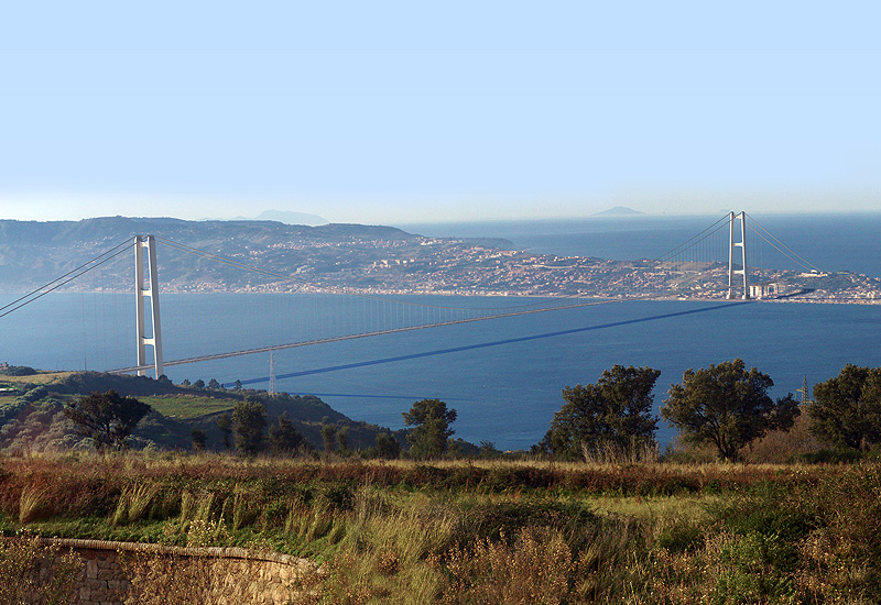
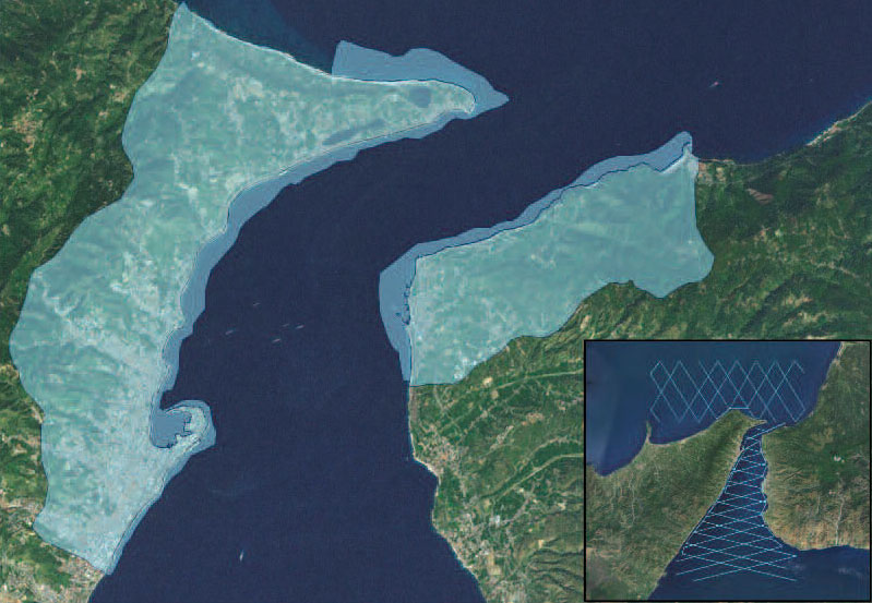
A broader area: covering a much larger area: around 43 km² in Sicily, 15 km² in Calabria, and over 1,600 km² at sea. This includes areas of natural significance such as Sites of Community Importance and Special Protection Areas. The aim is to systematically study the environmental and social effects over a lengthy time frame and across a broader geographical area.
The area covered by monitoring
A SINGLE MANAGEMENT SYSTEM
All the recorded data will be managed through a digital information system or EGIS(Environmental Geographic Information System), a web-based platform that will enable us:
to store and consult historical data;
to view data in real time (graphs, tables, GIS maps);
to keep track of reports and issues;
to share data with public bodies, research centres and, in part, with the public;
to support operational and strategic decision-making.
Briefly, the environmental monitoring plan has been conceived to operate alongside the design for the Strait of Messina Bridge by providing scientific rigour and ongoing traceability. In addition to overseeing the effects of the project and the implementation of corrective measures, the Plan aims to develop know-how, providing a knowledge base for use not only by those involved in delivering the project, but also by public bodies, environmental agencies and research centres. By sharing data in a structured way, the results of environmental monitoring will help to enable experts and scientists to assess one of the most complex and important infrastructure assets in Italy and Europe.
BENEFITS FOR THE LOCAL AREA
The strategic value of the project will lead to new opportunities for social and economic development in the areas involved, not only in terms of logistical potential, but above all with regard to social improvements and urban regeneration.
APPLICATION OF SUSTAINABILITY METHODS AND STANDARDS
We apply the methods and standards developed for sustainable infrastructure which, from design through to construction, have set sustainable environmental, social and economic development goals.
ENVIRONMENTAL MANAGEMENT OF WORKSITES
Construction of the infrastructure will be a complex process, also involving a major commitment in terms of environmental sustainability. With a view to raising the bar still further, the Environmental Management System for our worksites, which complies with the UNI EN ISO 14001 standard, will enable us to organise worksites in such a way as to guarantee constant oversight of environmental aspects, in part by interfacing with the Monitoring Plan.